ZIP Code 5: 63453 - LURAY, MO
ZIP Code 63453 is the postal code in LURAY, MO. Besides the basic information, it also lists the full ZIP code and the address of ZIP code 63453. Whatsmore, there is more information related to ZIP Code 63453. For example, nearby ZIP code around ZIP Code 63453, etc.
ZIP 63453 Basic Information

The basic information of ZIP Code 63453 is as follows, including: country, county, city, FIPS and etc.
| State | County | City | ZIP Code 5 |
|---|---|---|---|
| MO - Missouri | Clark County | LURAY | 63453 |
What is the plus 4 zip code for 63453 ZIP Code? Below is the detail.
63453 ZIP+4 Code List

What are the 4 digit zip extensions of ZIP Code 63453? ZIP code 63453 has many plus 4 codes, and each plus 4 code corresponds to one or more addresses. Below we list all the ZIP+4 codes and their addresses in the ZIP Code 63453. You can find a 9-digit ZIP Code by a full address.
| ZIP Code 5 Plus 4 | Address |
|---|---|
| 63453-1026 | 101 (From 101 To 199 Odd) TATE ST, LURAY, MO |
| 63453-1027 | 301 (From 301 To 399 Odd) LUSLEY ST, LURAY, MO |
| 63453-2000 | 13400 (From 13400 To 13498 Even) SOUTH ST, LURAY, MO |
| 63453-2001 | 13300 (From 13300 To 13398 Even) SOUTH ST, LURAY, MO |
| 63453-2002 | 13801 (From 13801 To 13899 Odd) SOUTH ST, LURAY, MO |
| 63453-2003 | 21600 (From 21600 To 21698 Even) 2ND ST, LURAY, MO |
| 63453-2004 | 21501 (From 21501 To 21599 Odd) 3RD ST, LURAY, MO |
| 63453-2005 | 21600 (From 21600 To 21698 Even) 4TH ST, LURAY, MO |
| 63453-2006 | 21500 (From 21500 To 21598 Even) BROADAS ST, LURAY, MO |
| 63453-2007 | 21600 (From 21600 To 21698 Even) COUNTY ROAD 111, LURAY, MO |
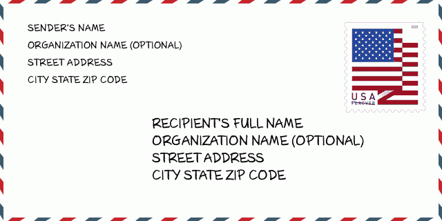
How to write a U.S. envelope?

-
First, you need to fill in the recipient's mailing information in the center of the envelope. The first line is the recipient's name, the second line is the street address with a detailed house number, and the last line is the city, state abbr, and ZIP Code.
Second, write the sender's information on the left top corner of the envelope. If your mail cannot be delivered, it will return to the sender's address.
Finally, don't forget to stick the stamp on the right top corner. Otherwise, the letter will not go into the delivery process.
Here is the envelope example below.
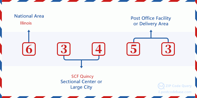
What does each digit of ZIP Code 63453 stand for?
-
The first digit designates a national area, which ranges from zero for the Northeast to nine for the far West.
The 2-3 digits represent a sectional center facility in that region.
The last two digits designate small post offices or postal zones.
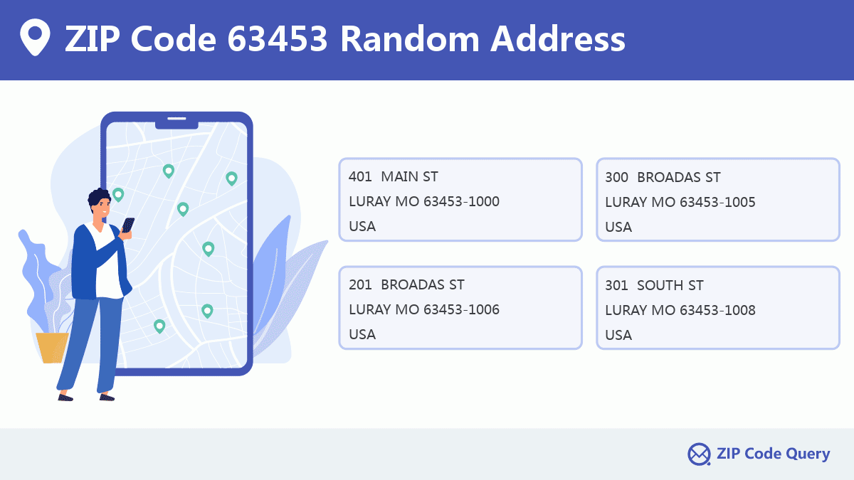
Random Address in ZIP 63453

ZIP Code 63453 has 451 real random addresses, you can clicking the picture below to get random addresses in ZIP Code 63453.
ZIP 63453 Online Map

This is online map of the address LURAY, Clark County, Missouri. You may use button to move and zoom in / out. The map information is for reference only.
ZIP 63453 NearBy ZIP Code
The Nearby ZIP Codes are 63442, 63432, 52573, 63445, and 63465, you can find ZIP codes in a 25km radius around ZIP Code 63453 and the approximate distance between the two ZIP codes.
The data has a slight deviation for your reference only.

School in ZIP Code 63453

This is the ZIP Code 63453 - School page list. Its detail School Name, Address, City, State, ZIP Code is as below.
- ·School Name:Luray Elem.
- ·Address: Po Box 248
- ·City: Luray
- ·State: Missouri
- ·Grades: KG-8
- ·ZIP Code: 63453
Comment


Add new comment